Tropical Storm Isaias keeps gaining speed as barrels up the East Coast, inundating cities from both the sea and the sky while bringing winds that could rival Superstorm Sandy in 2012.
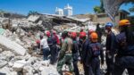
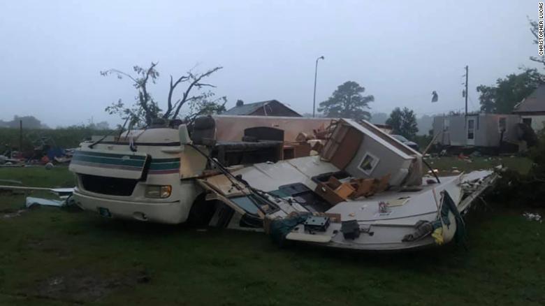
At least two people were killed Tuesday when a tornado struck a mobile home park in Windsor, North Carolina, Bertie County officials said. Twelve people were injured and taken to hospitals.
More than a dozen tornadoes have been reported in North Carolina, Virginia, Maryland, and Delaware, CNN meteorologist Brandon Miller said.
Now the storm is starting to thrash major cities in the Northeast, knocking out power to more than 2 million people as the country simultaneously grapples with coronavirus.
As of 2 p.m. ET, Isaias was “racing” across eastern Pennsylvania and into southeastern New York, the National Hurricane Center said.
A tornado watch has been issued for several major cities, including New York City and Philadelphia, until 4 p.m. Tuesday.
The watch also includes parts of southern Connecticut and New Jersey.
What makes Isaias particularly dangerous is how fast it’s traveling. By Tuesday afternoon, the storm was heading north-northeast at 40 mph, up from 33 mph a few hours earlier.
That rapid movement means Isaias won’t weaken very much as it continues up the East Coast, CNN meteorologist Chad Myers said.
It also means tornadoes can drop with little or no warning. “If you get a (tornado) warning on your phone, make sure you pay attention to it,” Myers said.
“You might not have 20 minutes with storms like this.”Isaias made landfall as a Category 1 hurricane late Monday night near Ocean Isle Beach, North Carolina.It was downgraded to a tropical storm Tuesday, whipping maximum sustained winds of 70 mph. But “the storm is still packing a dangerous punch, with over 112 million under tropical storm warnings,” CNN meteorologist Dave Hennen said.
By Tuesday afternoon, more than 2 million electricity customers had lost power, according to poweroutage.us. Each customer can represent a household or a business, meaning the number of people without electricity is likely much higher.
What to expect (and when)
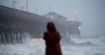
Some East Coast cities are getting deluged from both the sky and the sea, with torrential rainfall and storm surges. Philadelphia will keep getting pummeled until 4 p.m, with expected wind gusts of up to 65 mph and about 3 to 5 inches of rain, CNN meteorologist Brandon Miller said. New York City will endure its toughest conditions until 7 p.m. A storm surge of 1 to 3 feet is expected, in addition to 2 to 3 inches of rain and wind gusts of up to 70 mph.
Boston will get hit between 8 p.m. and 11 p.m., with wind gusts of up to 50 mph and less than an inch of rain expected.
‘Life-threatening’ floods and collapsed houses
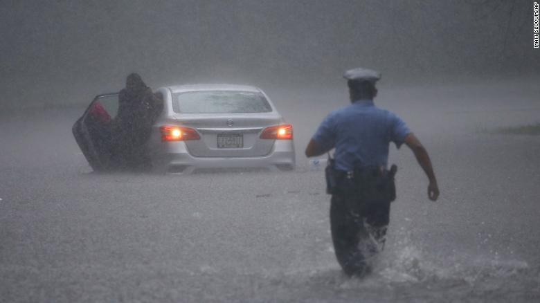
“Isaias poses a significant risk of life-threatening flash and urban flooding from heavy rainfall for areas along and just west of the I-95 corridor through tonight, from northern Virginia into upstate New York,” the National Hurricane Center tweeted.
And tropical storm conditions will last throughout Tuesday and into the overnight hours.
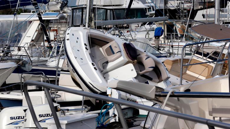
Brunswick County, North Carolina, reported numerous calls for water rescues, structural fires, structural collapses, and people trapped in flooding houses,” Oak Island Water Rescue said on Facebook.
Howling wind and water washing across in “one to two-foot swells” closed a bridge Monday night in Sunset Beach, North Carolina, the Sunset Beach Police said on Facebook. Streets in Holden Beach became rivers as water quickly rose, Jessi Viox told CNN.”Getting ready for Round 2,” Viox said. “The eye has moved around us, and now here comes the back end.”
Even before Isaias made landfall, the top of the Apache Pier Pavilion was seen lifting off in the wind.
And multiple structures in Ocean Isle Beach caught fire, according to the Horry County Fire Rescue in South Carolina.
The system could bring the strongest winds to New York City since Superstorm Sandy almost eight years ago, said Ross Dickman, the meteorologist-in-charge at the National Weather Service office in New York.
“The wind and flooding impacts from Isaias will be similar to what the city has seen from some of the strongest coastal storms,” such as nor’easters, he said.”But we haven’t seen one this strong in many years.
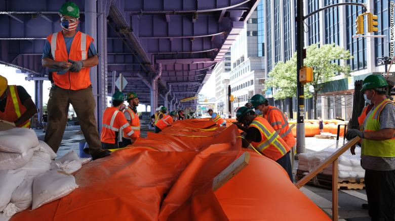
“New York City installed temporary barriers to prevent flooding in Lower Manhattan.
And in Maryland, Gov. Larry Hogan suspended Covid-19 testing operations at community-based sites for Tuesday.
Thousands of evacuations
The North Carolina Department of Transportation (NDOT) evacuated more than 3,000 people off Ocracoke Island on Monday, CNN affiliate WAVY-TV reported.
“The most important thing is to get out of harm’s way if you are told to evacuate,” Gov. Roy Cooper said. “Try to have a plan to stay with friends or family outside the danger zone.
“Some North Carolinians rushed to stock up on supplies, unsure how long it will take to recover from the storm.
“You never know,” Eli Thompson of Avon told WAVY-TV. “We’ve been hit with worse surprises, so there really is no amount of over-preparations that you can do.”
CNN’s Madeline Holcombe, Joe Sutton and Tina Burnside contributed to this report.