It’s almost here.
The long-awaited cloud of Saharan dust is poised to “hit” the U.S. Gulf Coast on Thursday and Friday, forecasters say, promising hazy skies and fiery red sunsets but also potential health problems.
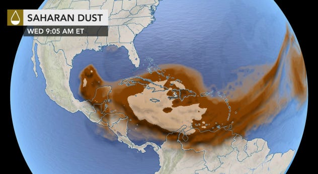
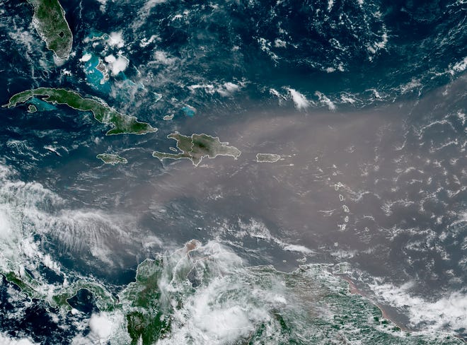
Nicknamed “Godzilla” for its unusually large size, the plume of dust began to emerge off western Africa last weekend and now has traveled over 4,000 miles from the Atlantic Ocean to the Caribbean Sea and Gulf of Mexico, the Weather Channel said.
The mass of extremely dry and dusty air known as the Saharan Air Layer forms over the Sahara Desert and moves across the North Atlantic every three to five days from late spring to early fall, peaking in late June to mid-August, according to the National Oceanic and Atmospheric Administration.

It can occupy a roughly 2-mile thick layer in the atmosphere, the agency said.
“The main impacts of the Saharan dust are a whitening of the sky during daylight hours, redder sunsets, and decreased air quality,” the National Weather Service said.
Several Caribbean islands were coated with dust earlier this week.
“This is the most significant event in the past 50 years,” said Pablo Méndez Lázaro, an environmental health specialist with the University of Puerto Rico. Due to the extremely poor air quality, “conditions are dangerous in many Caribbean islands,” he said Monday.

AccuWeather hurricane expert Dan Kottlowski said that “this is probably the worst air quality caused by Saharan dust in recent memory.”
Poor air quality can aggravate those suffering from respiratory issues such as asthma and COPD, the Weather Channel said.
“Air quality could also drop to moderate to unhealthy this weekend over South and East Texas due to the dust,” Kottlowski said. “So, people with respiratory issues should not spend any long periods of time outdoors. Some people with severe respiratory conditions may just want to stay indoors.”
Dust and water particles in the atmosphere are responsible for scattering sunlight, creating the rich colors of sunsets and sunrises. With the added dust in the atmosphere, a greater number of particles can refract sunlight into a range of purples, pinks, oranges and yellows.
After making its way to the Gulf Coast, some of the dust may then move as far north and east as the Ohio Valley and mid-Atlantic this weekend, the Weather Channel said.
Contributing: The Associated Press; Kelly P. Franklin, the Austin-American Statesman
#SATELLITE SPOTLIGHT: This #SaharanAirLayer (#SAL) tracking animation shows how the plume of #dust and #sand from the #SaharaDesert has moved westward over the last 5 days. Areas of red and pink represent the dry, dusty air as seen from @NOAA's #GOES16 🛰️ pic.twitter.com/mh7gULXFSU
— NOAA Satellites – Public Affairs (@NOAASatellitePA) June 23, 2020


